Hide advertising, enable features from $8/month
5 year ago
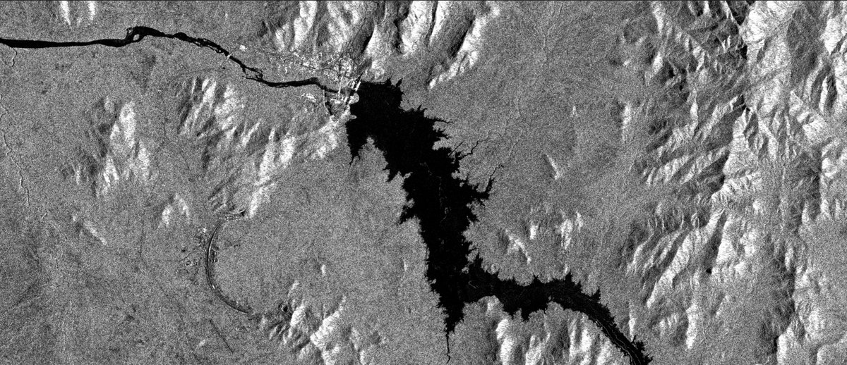
Grand Ethiopian Renaissance Dam: Sentinel-1 satellite images from @esa taken over the dam from 27 June and 9 July shows the increase in water being held back at the dam. This is radar imagery, so the water shows as dark, the land is lighter

Keywords
#Ethiopia news#Ethiopia map

